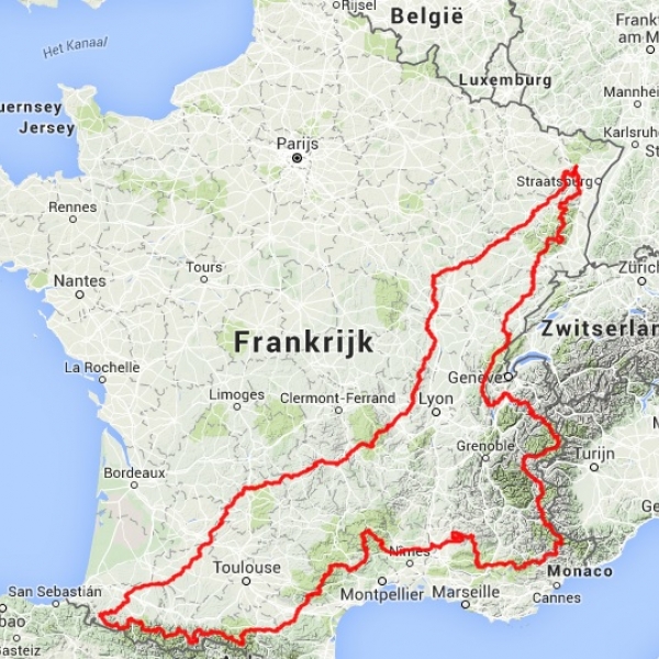
The map shows the route: a series of mountainous tracks, starting in the North-East in Saverne near Strassbourg. It goes from Vosges to Burgundy and Massif Central, and further to the Pyrenees.
We cross the Pyrenees from West to East, heading to the Alps through the Cevennes. After the Alps we pass the Jura and once more the Vosges, finishing in Saverne again.
Toughness
The steepness of cols is varying. Most major cols are between 7 and 12% steep, but there are a few steeper climbs such as Marie Blanque, Menté, Portet d'Aspet, Peguère, Solpérière, Ventoux, Buis, and Grand Colombier.
Itinerary
The road book is compact, loose-leafed, descriptive and gives a wealth
of information. A height
profile is included in the package. The best way to
follow the route is to buy the well-known Michelin maps (1:200
000
or 1:150.000). If you don't want to take a full
backpack with all these maps, we recommend to make a
smaller copy, draw the route and cut it into pieces.
You may also want to buy the Michelin atlas and cut out
the required pages or pieces.
The track is updated at least every two years. The most recent updates are listed on the page Changes.