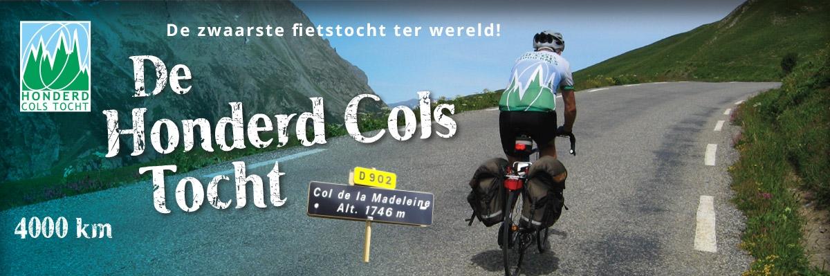
Route changes
At least every two years the route is changed. If you are a registered participant you may apply for an updated package by transferring the amount due (see page tariffs) to our bank account. Mention "update" and your registration number.
The list below shows the changes that were made over the last few years. The most important changes are marked green.
The consequences of the changes are shown for the distance D, number of cols C, the total height denivellation H and the number of control points S.
2024
[D = 4086 km C = 113 H = 69,7 km S = 44]
- km 168: Xertigny - Bains-les-Bains (10 km)
After Xertigny we used to turne left after 5 km so as not to stay on the busy D434 for too long, but on smaller roads to Bains-les-Bains.
Now we turn left already after 500 meters, and thus avoid almost the entire D434.
- km 415: Santenay - Aluze (9 km)
The municipality has made the road to Valotte and the road afterwards into a one-way road. That is why we are now going along the Canal de Center to Aluze.
- km 468: Col de Brancion - Blanot (11 km)
We do not descend that long after the Col de Brancion, but after 1.5 km we turn left at the Chateau de Noble, to the Col de la Pistole. At Blanot we return to the route. After Blanot the road continues up to a peak that we called Col de la Percée, but this is a mistake. It turns out that the Col de la Percée is slightly off the route, on the D117. We have now renamed that slope Côte du Mont Epinet, because it is very close to the top of that mountain.
- km 698: Arlanc - Laval-s/-Doulon (35 km)
Previously, after Arlanc we used to take the Côte du Procureur to La Chaise Dieu, and from there to Brioude via the D499. That road is now upgraded, and no longer suitable for cyclists. Because we hardly got to the town of La Chaise Dieu anyway (only the stampers went into the town) we deleted that control place. From Arlanc we now immediately go up via a much shorter (and therefore much steeper) route to Mayres. That is a côte with an index of 1.7 with passages of more than 10%. At Laval-s/-Doulon we return to the route. They are beautiful quiet roads. This route is 11 km shorter.
- km 1305: Maslacq - Côte de Camptort (16 km)
The route took the boring D10 and the busy Côte de Camptort to Navavrenx. We now take many smaller roads and the Côte du Crotz de Lopin to the D111. There we return to join the route exactly at the top of the Côte du Camptort.
- km 1345: Mauleon-Licharre (1 km)
In recent years, one-way traffic has been introduced in the town, and we had then to find another route through the city. But a bicycle lane has now been created along the streets, so we are now allowed to pass there again.
- km 2580: The Côte des Hautes du Toulourenc has been renamed Côte de Bluye.
- km 3024: Guillestre - Montgauvie (4 km)
This road goes through a narrow gorge. Two-way cars sharing the road with cyclists is dangerous. That is why the road is now forbidden to cyclists. There is a diversion higher up, which gives us an extra climb, the Côte de la Viste (index 0.5).
- km 3351: Cohennoz - Thénésol (14 km)
After Cohennoz we used to descend into the Arly valley near Ugine. Now we do no longer go all the way into the valley, but turn left halfway to climb the Col de la Forclaz-de-Queige (index 2.3). We descend via the Col de Montessuit, which is not too intense with an index of 0.8.
There are more cols called Forclaz (also one in Switzerland). The best known is along Lake Annecy, and it is called the Forclaz-de-Montmin, to distinguish it from the one at Queige.
Cols
Dropped: Col de la Percée (replaced by Côte du Mont Epinet)
New: Col de la Pistole | Col de la Forclaz-de-Queige | Col de Montessuit
2022
We strive to diminish the use of control carnets. For this reason we encourage the use of GPS-records for the verification of your tracks. The GPS verification is automated using more than 200 control points along the track. Therefore we also increased the number of control points for the paper carnet users to 46.
[D = 4092 km C = 111 H = 69,1 km S = 46]
- km 2424: We left out Sauzet, instead after the railway crossing we go right, immediately to the cycle-bridge over the river Gard to Moussac
- km 3897: Until now, after the Grand Ballon and the Platzerwasel, we descended directly to Munster. But now we take an extra tour at Sondernach, to climb the Petit Ballon, a slope of 10 km with an index 3,2.
- km 4067: The ascent of the Col du Schanz from Still had become very bad, due to the heavy forestry traffic. so we chose an alternative route by the Côte de Froeschacker (index 0,9) and a another road to the top of the col from Westhoffen (index 1,6). This ascent is much steeper than the old road fro Still. This ascent is much steeper than the old road from Still.
Cols
Dropped: -
New: Col du Petit Ballon |
2021
[D = 4082 km C = 110 H = 68,3 km S = 37]
- km 2286: We do not longer take the Col du Minier to L'Esperou and the Mont Agoual, but the Col de la Lusette.
- km 2585: We used to go directly from Malaucene to Entrechaux, and further to the Col de Veaux. Now we take the road to the viillage of Veaux, with two new (not too heavy) cols.
- km 2871: The old route took the beautiful Gorges du Cians, a narrow canyon near Beuil, and further by the Col de la Couilolle to St. Sauveur. Now we take the road left halfway the Gorges to climb the Col de la Sinne. A spectacular road where you won't encounter a single human being.
- km 3080: After Briançon we always took the very busy main road Route National N91 (now a Route Departementale, D1091) to the Col du Lautaret. We already avoided the busy road a few times in the beginning of this road by taking a detour through some villages in the valley, but now we extended this to almost the complete ascent. Near Pont de l' Alpe we resume the D1091.
- km 3415: The old route took the cols du Saisies and Aravis, right across Annecy to the Grand Colombier. That has become very difficult, so a few years ago we diverted the route to the north to avoyd the busy traffic.We succeeded only partially. So now we go directly after the Col de Saisies to the west via Crest Voland, and further via the Col de Vorger, Col de Tamié to the south borders of the Lake Annecy. We take the Voie Verte (a cycle route by the former railroad track) to the north. At St. Jorioz we climb the super steep Côte des Marterays to the Col de Leschaux and further to the Col de la Chambotte. From there we descend to the Rhône valley and the foot of the Grand Colombier.
Cols
Dropped: Col du Minier | Pas du Voltigeur | Col de la Couilolle | Col des Aravis | Col de la Croix Fry | Col de la Fretallaz | Col du Clergeon |
New: Col des Mourezes | Col de la Lusette | Col des Astauds | Col de Gainons | Col de la Sinne | Col du Vorger | Collet de Tamié | Col de Tamié | Col de Leschaux | Col de la Chambotte |
2020
[D = 4088 km C = 107 H = 68,9 km S = 37]
Because most planed changes for the 2020 route were already implemented in the intermediate version 2019, only three improvement are made in this version.
- km 40: We used to ride to Sitifort via Rehtal, now we take an extra climb: Côte de Hommert, Only 1 km length, but quite steep (index 1,6).
- km 2228: We no longer cross the river Vis at Madières, but at the beautiful Cirque de Navacelles (a Unesco natural monument).
- km 4045: At Gresswiller we no longer take the road by the viaduct over the D1424. Instead we take the old route through a little cycle tunnel.
Cols
Dropped:-
2019
[D = 4083 km C = 107 H = 68,9 km S = 37]
Normallly we do not issue an update in the odd years.But in 2019 we have matched the distances in the paper version of the route with the GPS-version. The differences are not very big, but added over the 4000 km long route it appear to be 20 km shorter than we calculated. We were thus forced to generate a new profile and a new paper itinerary too. Therefore we decided to include all changes that were already explored for the 2020 version.
- Three controlpoints are deleted: St. Paul-s/-Ubaye, Levier and Ste.Marie aux Mines.
- km 868: After thee Puy Mary we used to take the Col de Bruel to Jussac. Now we go left already at Houades, and do no longer pass the top of the coll. We descend to the Col de Cheulles, and further to Jussac.
- km 962: After the Côte de la Liberation close to Saint Ceré, we avoid the busy D673 to Rocamadour. We now ride via Thégra.
- km 1000: After Payrac gaan do no longer pass Fajolles but instead Rouffilhac to Gourdon. It is not only shorter, but also easier to follow becaus Roufilhac appears on the direction signs.
- km 3910: After Munster in the Vosges we always took the road via the old sanatorium of Hasslach. Because the sanatorium is no longer in use, it is sold, and the road is closed now. In Munster we take a little road to the D5bis, the raod to the Collet du Linge.
Cols
Dropped: Col de Bruel |
New: Col de Cheulles |
2018
[D = 4104 km C = 108 H = 68,8 km S = 40]
In 2017 we have explored a lot of changes. Almost 15 of them are not included in the itinerary, because those were not considered an improvement. But 17 are implemented though.
- After Senones (km 100) we follow the cycle track at the former railroad track to Etival.
- At Bains-les-Bains (km 182) we take the tow path along the Canal de l’ Est to Fontenoy.
- The descent to Feurs (km 608) was done partly by the main road. We now go to Panissières via Salvizinet.
- In the past we already skipped a part of the ascent (km 646) of the Col de Croix de l’ Homme Mort (index 3,3), because it is part of the mainroad D996 between Issoire and.en St. Etienne. We now skipped the entire col, and replaced it by the much more quiet Col de Baracuchet (index 4,7, a little harder).
- Jussac (km 847) is no longer a control point. We now get our stamp at the Puy Mary.
- The busy D673 after Gourdon (km 1015) was already skipped partly from the route right after the city of Gourdon. After Salviac we avoid another part of that road. A little furher after Montclera we have a new route to Tournon, via Puy-l’Eveque.
- At Castelnau (km 1243) we now take the north ascent, a little more steep than the south ascent, but now we avoid a big part of the very busy D935.
- The road between Arzacq and Arthez (km 1306) is rather busy. Therefore we now go to Morlanne via Castillon. De Côte de Castillon is quite steep (12%) !
- The beautiful Col d’Aspin (km 1657, 1489 m, index 3,2) is replaced by two other (even more beautiful) other cols: De Hourquette d’ Ancizan (1564m, index 3,5) en de Col d’ Azet (1580 m, index 5,7). At Ancizan we added a new control point.
- After Foix (km 1916) we always took the D1 to Laroque-d’Olmes. But now we no longer go straight ahead before the Col de Py, but we take the road left to cross the top of the col. From there we have a new route via the Col de Charcany and Col de Sarnac (index 0,4 resp 0,3),
- After Laroque-d’Olmes (km 1944) we also found a more quiet road, the old railroad track to Chalabre.
- Also after Limoux (km 1988) we found more quiet roads via the Col de Gardie to St. Hillaire. From there we ride to Carcassonne via the Col de Castel.
- For years we were searching for an alternative for the D620 between Carcassonne (km 2039) and Caunes. At Vilalier we now take a detour via Villarzel.
- After the descent to St. Pons (km 2092) we do no longer take the main road to the Col de Cabaretou but via the former railroad track to Riols, and from there via the Col de Tabouriech to the Cabaretou.
- After the Cevennes we went via Brignon (km 2417) to Moissac. Now we go to the cycle bridge in Moissac via Sauzet.
- After Manosque (km 2703) we no longer go via Valensole to Moustiers-Ste.Marie, a very large tedious road. Instead we now take a route via Greoux-les-Bains.
- After the Cormet de Roselend (km 3304) we included the Col du Pré (1737 m, index 1,7). Very beautiful, but not as hard as other cols in the Alps.
- The Col de Bussang (km 3840) has been in the route from 1980. All these years it has been an eyesore for us. We now found a solution to take the old ascent after Bussang. Right before the top it joins the main road. So we take the descent via the main road, but this is no a big issue since we have the same speed as the other traffic.
Cols:
Dropped: Col de Croix de l'Homme Mort | Aspin | Loup |
New: Col de Baracuchet | Hourquette d'Ancizan | Azet | Py | Charcany | Sarnac | Gardie | Castel |
2016
[D = 4081 km C = 103 H = 67,0 km S = 39]
- Tarare (km 589): In the city we now go straight ahead, and take the steep Côte de Rochat (25%) to the D38.
- Gourdon (km 1016): After the city wo leave the busy D673 to ride a more northern route.
- Tourmalet (km 1633): At the ski center Superbarèges the road had been diverted. We follow the old route (Voie Laurent Fignon).
- Mont Aigoual (km 2300): After Mont Aigoual We do not go to the Col de Perjuret, but at Cabrillac we take right through the Gorges du Tapoul.
- Castellane (km 2787):
after the Gorges du Verdon we no longer ride via the Col de Siron to St. Auban, but via Castellane and the Col de St.
Barnabé (index 2,6).
- Argonay (km 3402): Beacause the D175 at Villaz no longer connects to the D1203, we can no longer cross that road there anymore. We now cross the D1203 somewhat more north, and hence take the Col de
Frétallaz from the other side.
Cols
Dropped: Col de Siron |
New: Col de St. Barnabé |
2014
[D = 4089 km C = 105 H = 66,9 km S = 40]
- Beaune-Santenay (km 398):
During the past years we already dropped a big part of the annoying D18 to Chalon. Now we also dropped the start of that route and take a bicycle track through the famous Bourgogne-winefields of Pommard, Meursault,
Puligny-Montrachet and Santenay.
- Auniac-Gourdon (km 1007): the last
kilometers to Gourdon we take a small road at the west-side of the railroad. We do no longer enter Gourdon at the ugly industries near the railway station.
- Puymirol-St. Urcisse (km 1117): as the bridge at St Nicolas over the Garonne is rebuilt, we could follow the former route to Puymirol again. But we prefer to take a new route via Lamagistere, because there are only very expensive overnight possibilities via the old route. The new route
to Lamagistere is somewhat easier to follow using the road-signs. We no longer ride through the village of Puymirol.
- Castelnau-Garlin (km 1253): we follow a beautiful route somewhat more south.
- Aubignan-Bedoin (km 2511): previously we changed the approach to the Ventoux from Carpentras (quite busy) to Aubignan. In the end we still had a portion of the busy D974. Now we take a detour via Beaumes-de-Venise to Bedoin.
- Fretallaz-Cuvat (km 3418): We used to leave the Col de
Fretallaz short before the top and went left to Les Diaquenods. Now we continue over the top of the col.
Cols
Dropped: -
New: -
2012
[D = 4095 km C = 104 H = 66,8 km S = 40]
- Vauvillers (km 201): We no longer pass Vauvillers. At Mailleroncourt
we go straight ahead to
Melincourt,
- Provencheres (km 3988): After the Col de Ste Marie we stay at the east side of the N159, via Combrimont.
Cols
Dropped: Col de Bluffy |
New: Col de Frétallaz |
2010
[D = 4088 km C = 105 H = 66,8 km S = 40]
- Beaune en Cluny:
between Beaune en Cluny (km 411) we follow a new attractive route. At St. Germain-les-Buxy we reach the old route.
- Brancion: right before Brancion (km 467) we follow nice small roads through Etrigny and Balleure,
- Montbrison: before and after Montbrison (km
644) we changed the route. We take a more northern ascension of the Col de Croix de l'Homme Mort, via a different track through the city.
- Garonnebrug bij St Nicolas disappeared:
since the old bridge over the Garonne at St Nicolas (km 1126) is demolished, we take a detour via Lafox, and found a new route to Puymirol over the bridge at Lamagistère,
- Col de Labays: the descension of the Col
de Labays to Issor (km 1480) that we dropped because of the bad road surface, is repaired and thus restored again.
- Bielle and Laruns: between Bielle and Laruns (km 1536) we now take the east side of the river, much more quiet.
- St. Claude: The road to Morbier is expanded. Therefore we now take the D126 via Lezat. A marvelous small road along the mountain railway.
- Ronchamps: we no longer pass Ronchamps to the Ballon d' Alsace (km 3.790), but a vey small road through the woods at Les Valettes. At Champagney we raech the old route,
- Côte de la Haitroie: after the Ballon d'
Alsace (km 3830) we take a small road from St. Maurice to Bussang via a new côte: Côte de la Haitroie.
Cols
Dropped: -
New: Col de Veaux |
Older route changes are only available in the Dutch pages of this website.